Spring City’s Parks: A little bit of everything

Spring City is a relatively small municipality – population about 3,400 – whose recreational facilities run the gamut from neighborhood parks to the Schuylkill River Trail.

Hall Street Park

My first stop was Borough Hall because I knew that Hall Street Park was adjacent to it, but I also needed some directions to two other parks. To get to the park itself, just go around the right side of Borough Hall and head up Hall Street. It’s got a decent incline, so just be forewarned. On your left, you’ll see the two full-court basketball courts, which are in excellent condition. The fencing on two sides ensures that your ball won’t be sailing down to the sidewalk and street below (as long as your shooting or passing isn’t too erratic!) The fairly steep-sloped grassy open space beyond the courts is probably really good for sledding, but perhaps not for ball games. There are a few benches under some trees that might make a nice shady spot for summertime reading.

Spring City Pool

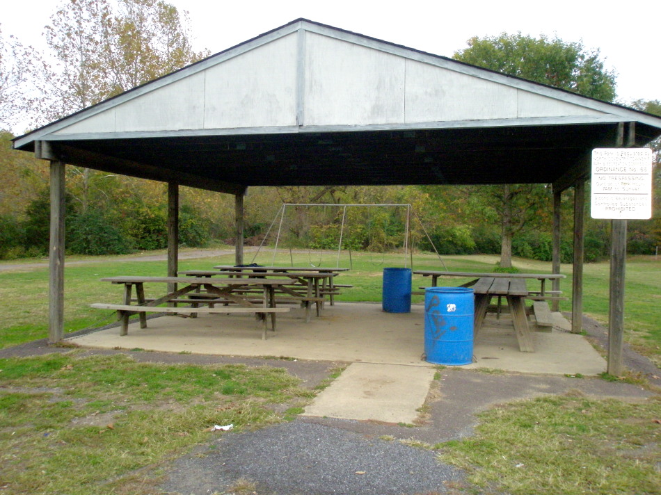
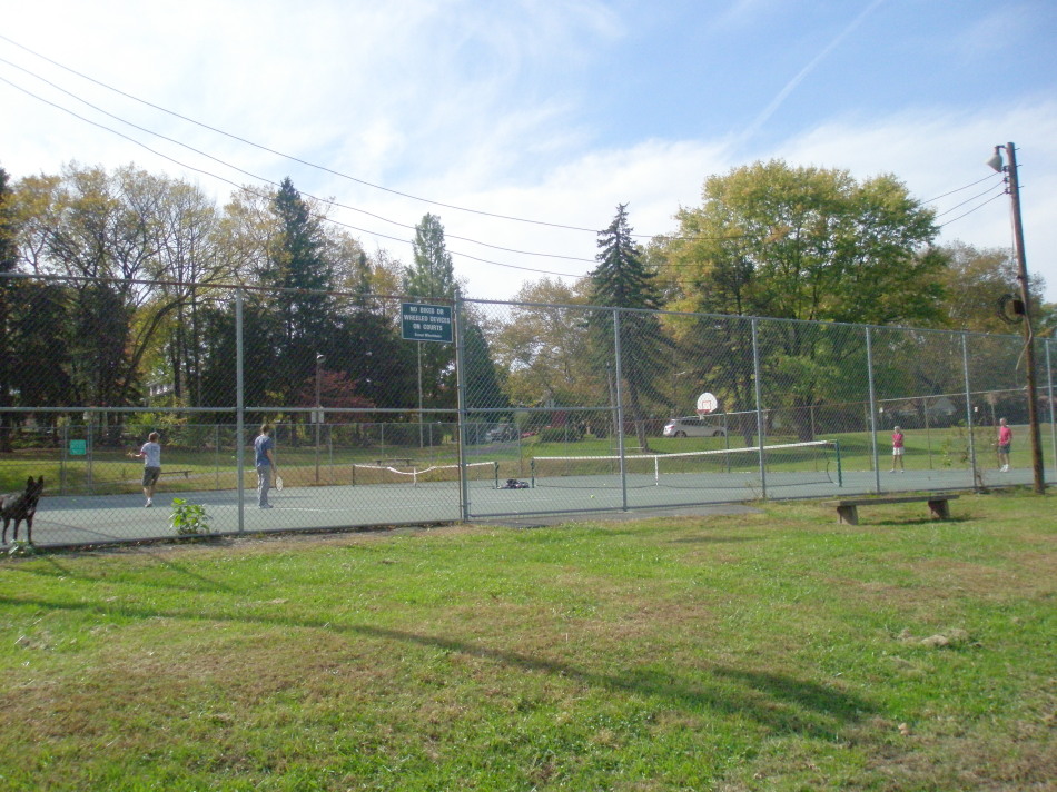
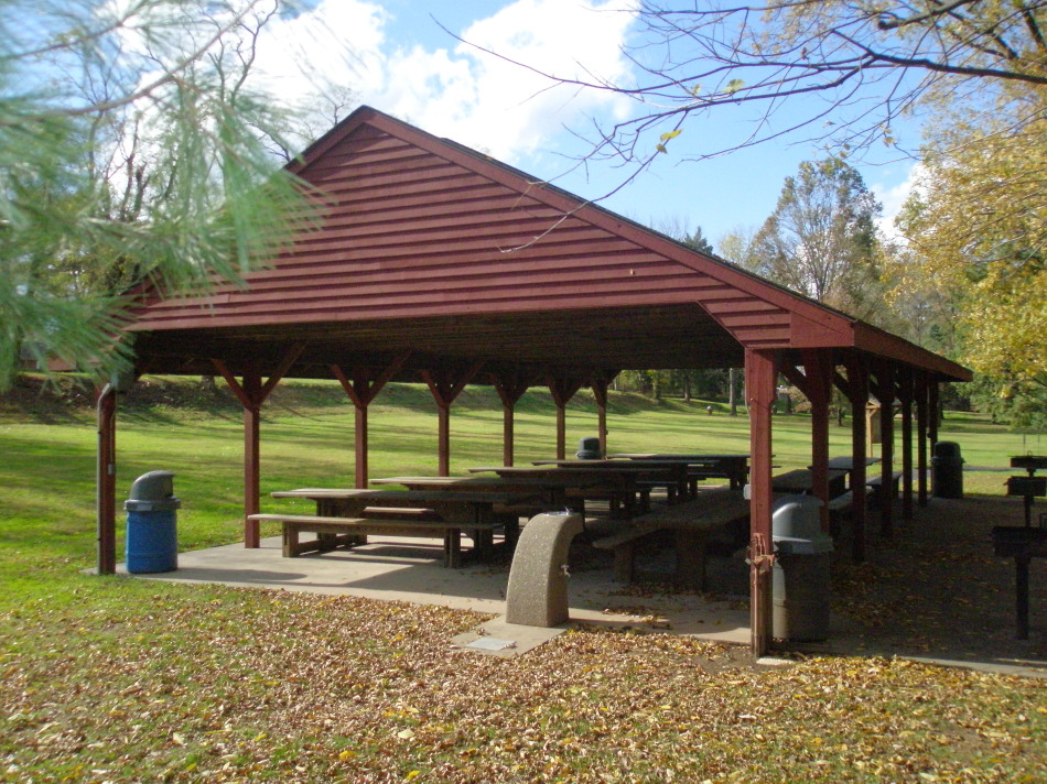
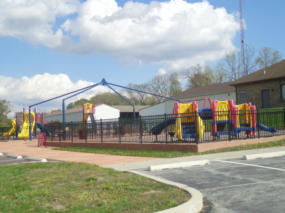
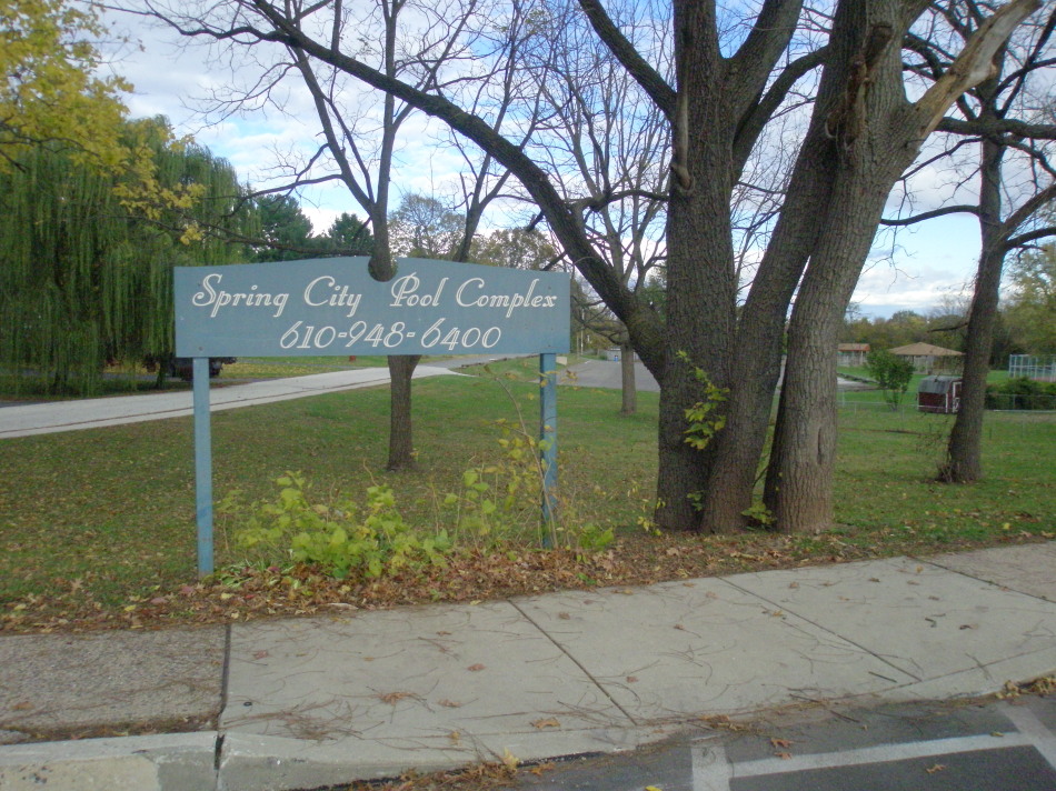
I got back in my car to get to the Brown Street Park, which is at the intersection of Brown and S. Wall Streets. I wished I’d been there on a summer day because this is the site of the Spring City Pool, which is run by a non-profit called The Community Association of Spring City. The public park also has facilities for tennis and basketball, a tot lot, open space and a pavilion. I imagine it’s a beehive of activity in the summers.

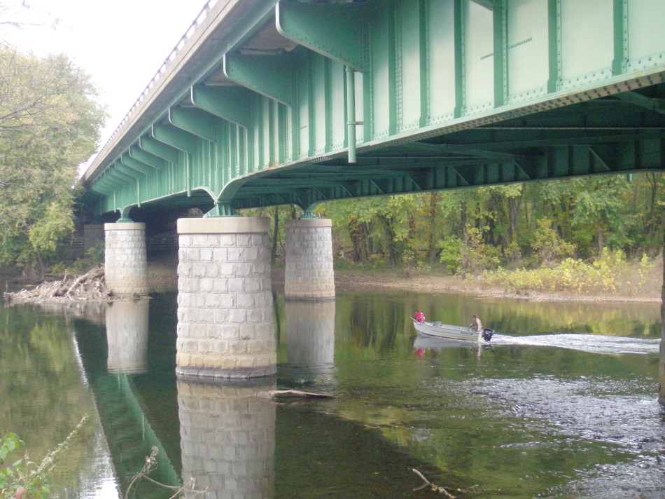
The Penn State study listed the third recreational location as the “Spring City Boat Ramp Area.” I couldn’t find any reference to it online. At Borough Hall, I was directed to the vicinity of E. Bridge Street and the bridge over to Royersford. On my way there, I stopped at the Burger King; no one there knew of any ramp on the Spring City side, but they did know the Phoenixville Boat Ramp. I figured I’d just go down to the river and have a look around anyway.

Royersford view

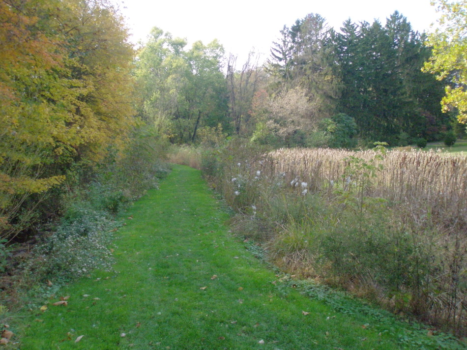
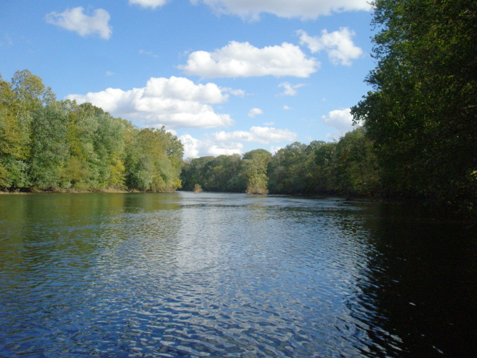
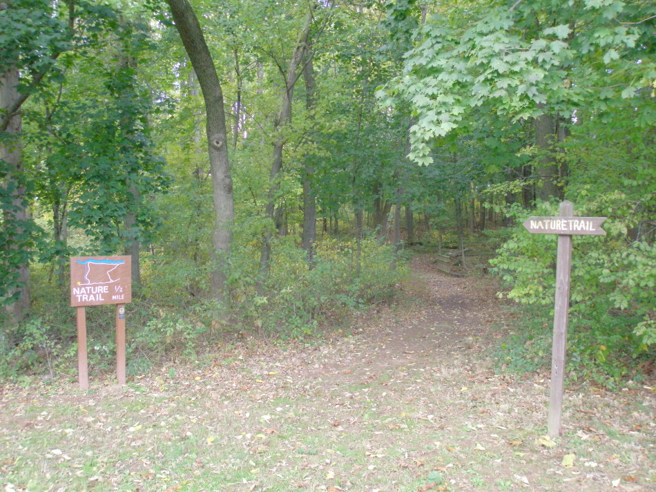
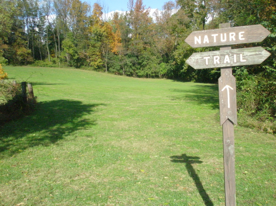
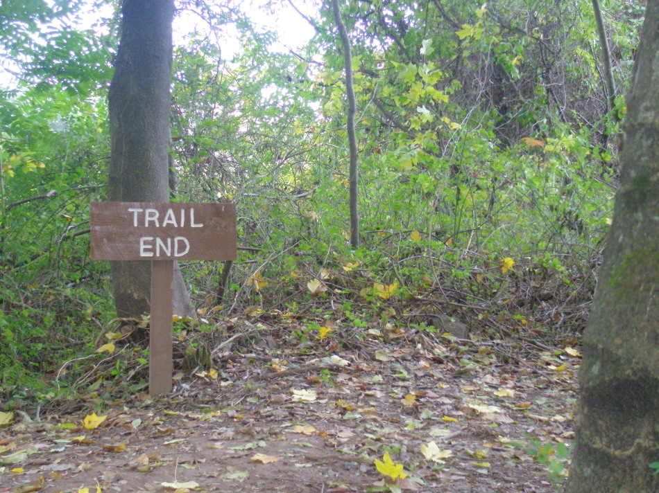
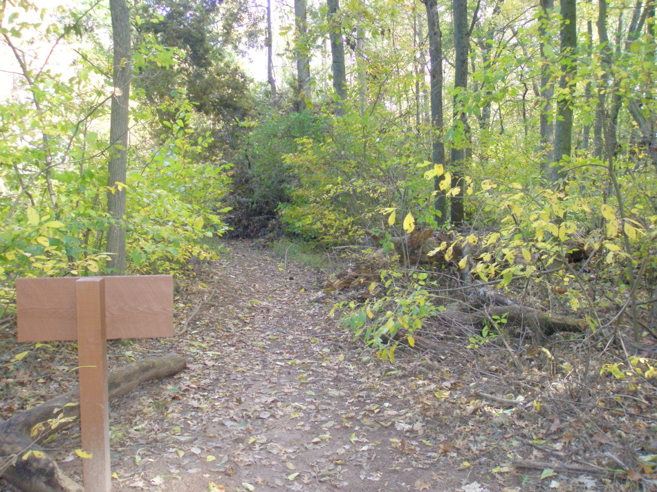
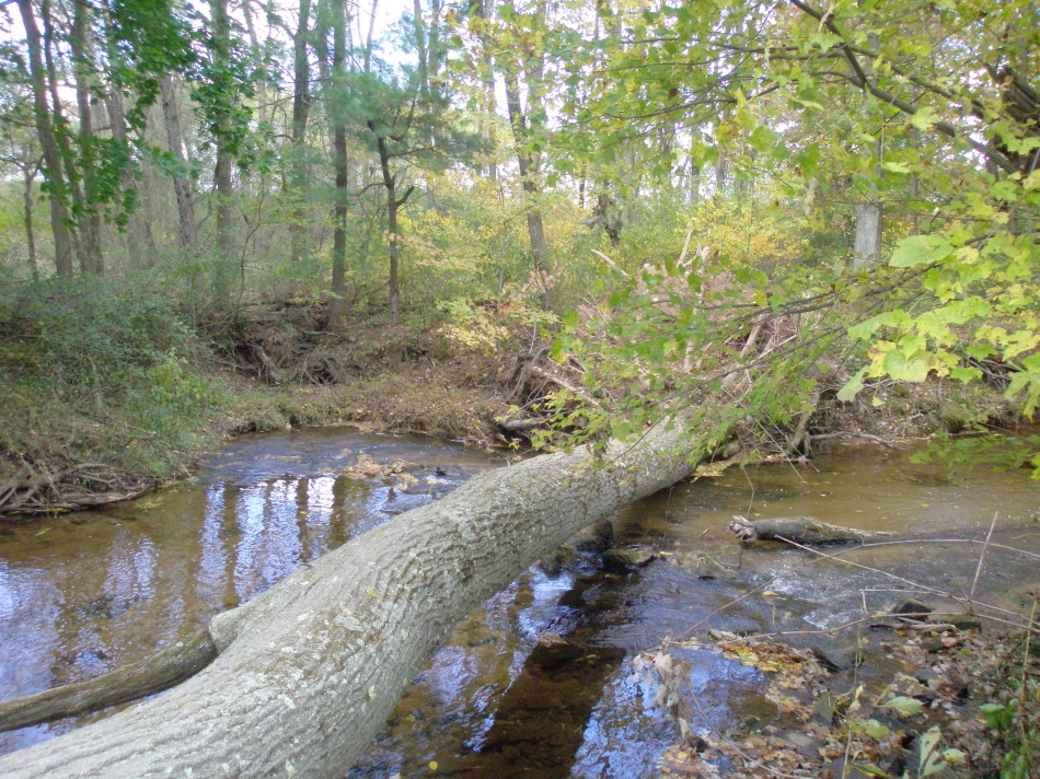
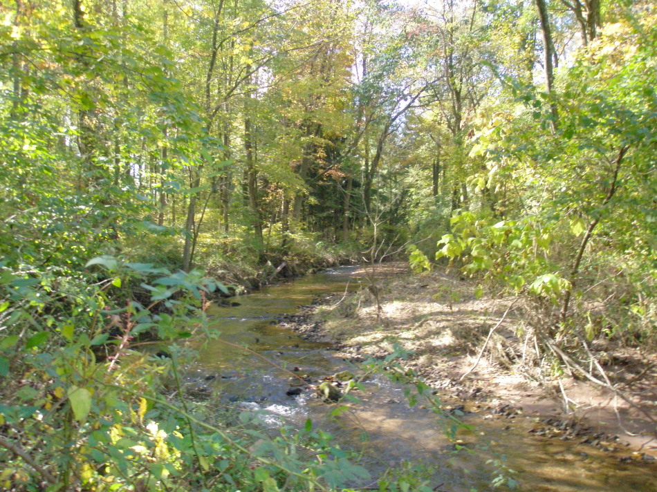
I’m glad I did because I got to take a walk along another segment of the Schuylkill River Trail, which was how I started out this whole series in Riverfront Park in Pottstown. Although I will wrap up the series with one more post tomorrow, this area in Spring City was actually the last one I visited, so it felt like a fitting end to my explorations.

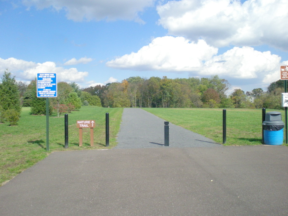
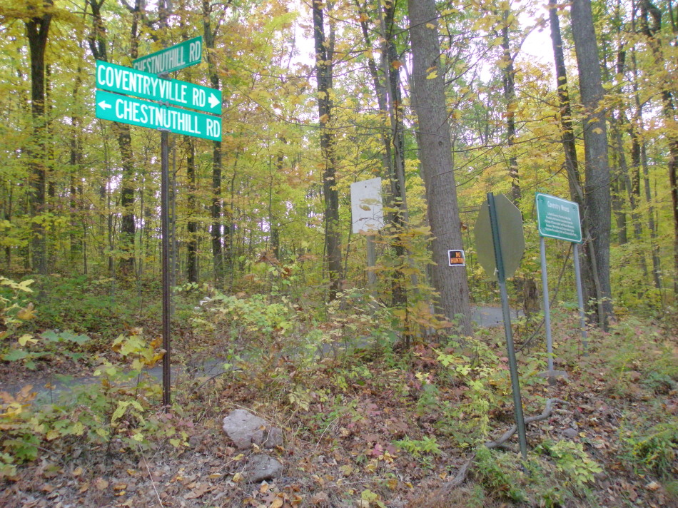
I walked along the trail in a southeasterly direction. If I had kept going, I might have eventually ended up in Phoenixville, although I don’t think that segment is completed yet. There was some trail construction taking place on the section leading from E. Bridge Street north toward Limerick. When I got home, I found details about the project at the Chester County Parks & Recreation website. They are constructing a 15-mile section between Phoenixville Borough and Pottstown. The website says that, “The 12-foot wide asphalt-paved trail will use PECO Energy right-of-ways, roadways, a canal towpath, public and private open space, and existing bridge and culvert structures.”

I’m going to try to keep track of the improvements and connections being made on the Schuylkill River Trail. The Trail promises to become a premier, regional recreational destination, bringing economic development potential to the towns it passes through. It should be interesting and exciting to see that transformation take place.

HALL STREET PARK
Location: 6 S. Church Street, Spring City, PA 19475, behind Borough Hall.
Size: ~2 acres.
Suitability: All ages.
Facilities: Two full-court basketball courts, fenced on 2 sides; open, hilly, grassy open space, benches, some trees.
Activities and tips: Walking up the grassy incline got my heart pounding! I feel I should issue a warning: See your doctor before starting any exercise program.
Hours: Dawn to dusk.

BROWN STREET PARK
Location: Turn down Brown Street at the intersection with S. Wall Street. On a GPS or mapping program, use 50 Brown St., Spring City, PA 19475.
Size: Unavailable.
Suitability: All ages.
Facilities: Tennis, basketball, pavilion, public pool, tot lot, open space, parking.
Activities and tips: Tennis courts are inviting. Basketball court is in parking lot and might not be available when it’s crowded at the pool.
Hours: Dawn to dusk.

SPRING CITY SCHUYLKILL RIVER TRAIL
Location: Use 10 E. Bridge Street, Spring City, PA 19475 on a GPS or mapping program.
Size: Unavailable.
Suitability: All ages.
Facilities: Cleared and paved trail along Schuylkill River.
Activities and tips: Check Chester County Parks & Rec website before going out. Some parts of the trail may be closed while trail construction is underway.
Hours: Dawn to dusk.

Contact:
Spring City Borough (Chester County)
6 S. Church Street
Spring City, PA 19475
Phone: 610-948-3660
Website: http://www.springcitypa.net/

Follow the parks series at Mission: Healthy LivingPositively!PottstownTwitter(PositivelyPtown), Facebook, and The Mercury.

PHOTO GALLERY


Hall Street hoops

Hall Street hoops


Intersection, Brown & S. Wall Streets

Brown Street hoops

Brown Street tennis

Brown Street pavilion

Brown Street tot lot

River Trail

River Trail

Roots along the Trail

E. Bridge/Trail improvement area

E. Bridge/Trail improvement area

Coventry Woods: North Coventry’s natural wonder

On my first visit to Coventry Woods, I was alone on a Sunday afternoon. I found an access point at 2145 Coventryville Road, at the intersection with Chestnut Hill Road. After climbing an unpaved, steep incline in my car, the terrain leveled off and I came to a grassy parking area. From there, I could continue on foot in the same general direction or go off to the right, past a pavilion, down a trail clearly marked by bright red rectangles on tree trunks. I decided on the marked path, although there wasn’t a trail map at the trail head, so I didn’t know if the trail looped around or how long it was. I wasn’t comfortable heading off into the great unknown by myself, but I figured I’d at least walk a little ways to see what I could see.

Red trail, Coventry Woods

Within a few minutes, I noticed some trees with orange markers, and shortly thereafter came upon an impressive signpost. It was clear then that this park had an extensive trail system. Apparently, there are trail maps at other access points, but just to be safe, hikers will want to print out this Coventry Woods Trail Map before they head out to experience this awe-inspiring wilderness.

When I pulled out my copy of Walden by Henry D. Thoreau, which I was reading for my master’s writing program, I came across this quote: “I find it wholesome to be alone the greater part of the time. To be in company, even with the best, is soon wearisome and dissipating.” As much as I would have liked to be in sync with Thoreau in that moment in Coventry Woods, I just wasn’t. (Where was Rosemary and her entire family when I needed them?!)

Fortunately, I had my North Coventry guides on my second visit to Coventry Woods. We went in at the Fernbrook access point at the intersection of Fernbrook Lane and St. Peters Road. The Township recently acquired this 39-acre parcel with numerous buildings from Nueva Esperanza Youth Camp. The purchase was made possible by a grant from the Pennyslvania Department of Conservation and Natural Resources.

Fernbrook Access

This wasn’t the first purchase made from the former owners of the camp. Over the past several years, the township has been buying parcels as funding has become available. This area is part of the Hopewell Big Woods, generally known as the most important mature forested landscape in southeastern Pennsylvania. Plugging the Coventryville Road address into Google maps or Google Earth gives a pretty good idea of the scle of this valuable ecological and recreational resource.

A couple days after this visit, Jay Kline, planning commissioner, sent me a document from their Open Space Committee (North Coventry Saved Lands Stats). It shows that since North Coventry’s 2002 open space referendum, they have saved 1,163 acres – land that will not fall victim to suburban sprawl. Their $2.1 million in open space funds leveraged $13.4 million more in private donations and state and county grants. Those acres include hundreds that now make up the 600+ acre Coventry Woods property, which may eventually connect to French Creek State Park and be part of a greenway through the township that connects to the Schuylkill River Trail.

As we walked through the Fernbrook area of Coventry Woods, which contains about a dozen rustic buildings, Andy Paravis talked about the possibility of renovating one of them for use as a nature center. I thought the site had real potential to serve as a retreat for school groups, clubs, or families just wanting to camp for a few nights in the wilderness, but there are no funds or plans to put any of the buildings into use at this time. However, there is a large pavilion with a new grill that’s available for rentals. Just get in touch with the Township at the number below.

Photo courtesy of Jay Kline
I also learned from Mr. Kline that the directional signposts that I’d seen on my first visit were made from wood recycled from a demolished building at Camp Fernbrook. And he explained another marker that I recalled seeing – one that said, “Charcoal Hearth.”

Wood from Coventry Woods was burned in large outdoor hearths to make charcoal. “The remains of each charcoal hearth along the trail is marked with the pictured sign. Charcoal made at Coventry Woods was used at Hopewell Furnace to make iron,” wrote Mr. Kline in an email. There are numerous hearths noted on the trail map.

To learn more about Hopewell Furnace and the amount of charcoal they needed, see this link. Mr. Kline also sent a link to this site, which explains the charcoal hearth model that was carried out in Coventry Woods.

What was really striking to me on the way back from Coventry Woods to the township building, via North Coventry’s riverfront parks, was the absolutely breathtaking farmland, the rolling fields and the autumn colors as a backdrop. And then, as we got closer to the river and the more densely-populated areas of Pottstown Landing and South Pottstown, we were clearly returning to the region’s town center – Pottstown. It seemed so obvious then, how regional planning should work: a greenbelt around what could be a thriving urban center. Despite all its complexities, it’s a goal to keep moving toward.

I’d like to thank Andy Paravis, Jay Kline and Police Chief Robert Schurr for their time and for providing so much information on North Coventry’s parks and open space.

COVENTRY WOODS
Location: 2145 Coventryville Road, Pottstown, PA 19465. Fernbrook Access: 1954 St. Peters Road, Pottstown, PA 19465
Size: 600+ acres
Suitability: All ages, except very young children will not be able to cover much ground on this sometimes hilly terrain.
Facilities: Trails, pavilions, and wilderness hiking through mature forest.
Activities and tips: See the map link in this article for other access points and parking locations.
Hours: 7 am to sunset.

Contact:
North Coventry Township
845 So. Hanover Street
Pottstown, PA 19465
Phone: 610-323-1694
Fax 610-323-7239
Mon-Fri 8:30a-4:30p
Website: http://www.northcoventry.us/

Follow the parks series at Mission: Healthy LivingPositively!PottstownTwitter(PositivelyPtown), Facebook, and The Mercury.

PHOTO GALLERY


Access road (to left) from Coventryville Rd. entrance

Pavilion near Coventryville Rd. access

Charcoal Hearth marker, courtesy of Jay Kline

Signpost made from recycled wood

Fernbrook access intersection

View from Fernbrook entrance

Another Fernbrook view

North Coventry parks offer river re-connection possibilities

North Coventry's boat ramp

At first, North Coventry’s parks along the Schuylkill River, just across the Hanover Street Bridge from Pottstown, presented a bit of a challenge. But it wasn’t due to any particular feature of the parks. It was their names. The names in the Penn State study didn’t seem to match up with what I could find online and there were no signs at the actual locations. Fortunately, I was able to get in touch with Andy Paravis, Chairman of the Board of Supervisors, and get to the bottom of things. We met at the Township building this past Friday, where I also met Jay Kline, chairman of the planning commission. They had several maps of the township’s parks and open space, and before the morning was over, I had learned a whole lot more about North Coventry’s open space accomplishments and some of the potential going forward. I’ll fit some of it into this post and more in the next one on Coventry Woods.

Sometime in the past few years, North Coventry grouped together several parcels in the South Pottstown area and now refer to them collectively as “Riverside Park.” These include: the boat ramp and parking areas near the intersection of Penn Street and E. Schuylkill Avenue; the Penn Street courts (basketball & tennis, not in use), and the horseshoe pits in a green space on E. Schuylkill Avenue at the intersection with Hanover Street. (The nearby Wampler Complex has four baseball fields which are owned by the Coventry Little League.)The Riverside Park designation also includes the ~1.4 acre park on River Road between S. York Street and Coyne Alley; this parcel has a playground, shade trees, picnic table and open space.

Further down River Road, at the bend in the road, you will come upon River Bend Park. This facility is home to the North Coventry Athletic Fields, and each of its three fields is dedicated to the memory of someone who contributed to the life of the Township: William R. Deegan, Sr., James R. Batdorf and Vernon Anderson. Near Batdorf Field there is a small pavilion with picnic tables and a swing set.

There is a noticeable difference in the quality of equipment between Kenilworth Park and the facilities that make up Riverside Park. Mr. Paravis confirmed that it’s a matter of money. Funds available for acquisition of properties are not allowed to be used for general stewardship, leaving some towns unable to maintain all of their parks to the same standards. I asked if there were any plans for the asphalt on Penn Street, where the tennis courts used to be and where there is still one basketball hoop.

“We’re going to have to re-consider those areas,” said Mr. Kline. “No one was really using the tennis courts.”

This was also the case at Pottstown’s Polluck Park, and I wondered if this was due to the “professionalization” of tennis for young children or due to more people playing year-round at indoor facilities. I may take some heat from Pottstown folks for thinking out loud that a reconfigured parking lot in the boat ramp area of North Coventry might be just the place for a kayak and canoe concession to attract more visitors to the river. Those visitors are going to be hungry when they get out of the water, and Pottstown should be the place they head for refreshments… which brings me to a subject that is close to Mr. Paravis’ heart: regional planning, in general, and regional recreation planning, in particular.

There is a really interesting study on my Pottstown 101 reading list about the ways in which Pottstown and North Coventry could coordinate the development of their riverfront recreational resources. It’s called Reconnections: “Reconnecting the people of North Coventry Township and Pottstown Borough with each other and their Schuylkill River Heritage.”

I took a ride with my North Coventry guides to visit Coventry Woods, which I’ll talk about tomorrow. On the way back, we detoured over to River Bend Park, where – if you get close to the river’s edge – you can see an old railroad trestle that crosses the river. The Reconnections study has a nice rendering (on page 40) of what that might look like as a pedestrian bridge that could allow people to cross from North Coventry and end up in Pottstown’s Riverfront Park, basically creating, for hikers and bikers, a loop with the Hanover Street and a larger loop with the Keim Street and Kenilworth bridges.

The study also presents some creative, upscale ideas for improving the gateway appearance and the pedestrian experience on the Hanover Street Bridge… for all those residents and visitors trying to enjoy the best that both sides of the river have to offer. With this kind of teamwork, I can easily envision a more vibrant waterfront for both Pottstown and North Coventry.

For those who are interested to learn more, I highly recommend the Reconnections study.

RIVERSIDE PARK
Location #1: E. Schuylkill Ave. and Penn St., Pottstown, PA 19465
Location #2: River Road & S. York Street, Pottstown, PA 19465
Size: ~2.5 acres total
Suitability: All ages.
Facilities: Location #1 – Boat ramp, dock, quoits, benches. Basketball court and two tennis courts are no longer in service. Location #2 – River Road area offers playground, shady seating area and large multi-purpose open space. Two volleyball courts are no longer in service.
Activities and tips: On the Sunday I visited, several people were putting their boats in. Isn’t it time to seriously consider getting a boat of your own?
Hours: 7 am to sunset.

RIVERBEND PARK & ANDERSON FIELD
Location: River Road, Pottstown, PA 19465
Size: ~9.5 acres total
Suitability: Youth involved in North Coventry baseball, softball and soccer leagues.
Facilities: Baseball/soccer fields, river views, benches, tables in grove, pavilion, swings.
Activities and tips: Looks like there used to be a trail along the river’s edge, beyond the ball fields, but it’s mostly overgrown now.
Hours: 7 am to sunset.

Contact:
North Coventry Township
845 So. Hanover Street
Pottstown, PA 19465
Phone: 610-323-1694
Fax 610-323-7239
Mon-Fri 8:30a-4:30p
Website: http://www.northcoventry.us/

Follow the parks series at Mission: Healthy LivingPositively!PottstownTwitter(PositivelyPtown), Facebook, and The Mercury.

PHOTO GALLERY

Entrance to Riverside Park boat ramp

Wampler Complex

Riverside Park Hoop

Riverside Park, former tennis courts

Riverside Park, Location #2, view from River Road

South York and Main Streets, South Pottstown

Riverside Park tot lot

At River Bend Park


Welcome, Mercury readers & outdoor enthusiasts!

A big shout-out to The Mercury for sending readers this way! Whatever kind of sports, hiking, biking, model airplane (!) or nature experience you’re looking for, you’re sure to find something at one of the many local parks in Pottstown and the surrounding region. Fellow blogger Rosemary Keane and I have had a great time discovering all these amazing resources.

Riverfront Park, Pottstown

Please visit the Parks & Rec page for a table of contents of all the articles we’ve published over the past five weeks, thanks to the support of the Pottstown Area Health and Wellness Foundation. You might also want to check out the Foundation’s Mission: Healthy Living website, which features not only the parks stories, but all kinds of other interesting health-related news to keep you and your family feeling good.

The parks articles here at Positively!Pottstown are organized by municipality, so you can locate parks in specific places or just browse and let yourself be inspired. Then pack a lunch, gather up the kids, friends, or your significant other and spend some time outdoors this weekend. You’ll be glad you did!

On the road…

I meant to post earlier, but I had limited email access today, and I was on the road… in North Coventry (fact-checking), South Coventry (stopping by Woody’s Woods), and East Vincent and Spring City (checking out their parks!)

I’ll be posting more on North Coventry’s parks this weekend and then will pick up with East Vincent and Spring City later next week… after Election Day has come and gone 🙂

In the meantime, check out the recent article on Connie Batdorf Park in South Coventry. Mrs. Peg Batdorf wrote in after reading the story. I’m honored to be able to post her response. Thank you, Mrs. Batdorf!

You might also want to see the newly added notes and photos for Woody’s Woods at the end of that same article.

And I’d like to send a big shout-out to reader Elise Buskirk, who pointed out something I missed at Kenilworth Park! Read the updated blog entry here. Thank you, Elise!

And now, a feast for the eyes…

Fall Glory, Community Park on the Ridge, East Vincent Twp.

Kenilworth Park: Classic community park with water views

Last Sunday we were blessed once again with mostly sunny skies and moderate temperatures, and active residents of North Coventry were out in their parks in full force.

I have vague recollections of playing softball in Kenilworth Park many years ago, but was blown away by its current facilities. Scherfel Field, which was the site of a baseball game on the day I visited, is well-groomed and seems to have been recently updated. There was a strong contingent of family and friends cheering the boys on. As a couple children climbed and swung on the nearby playground equipment, a foursome expertly battled on the tennis courts. While all these facilities are in excellent condition, what makes Kenilworth Park unique is its lake and trails system.

The trails around the lake and in the woods behind and adjacent to Scherfel Field provide a chance to re-connect with nature before or after a game, on a daily walk or perhaps a few times a week to de-stress after work. The lake view is very soothing. Visiting the park on your lunch hour might also do the trick, since there is a new lake overlook area with beautiful pavers, tables and a grill. Coming alone or with some friends in the middle of the day just might release those knots of tension in your neck and help you get through the afternoon!

Kenilworth Lake

Kenilworth Park has another ball field that did not seem to get much use for baseball or softball. There was a soccer net set up in the outfield, indicating its use for that purpose. There is a very nice pavilion, which is available for rent from the Township for family and group gatherings.

Although the main entrance with a plaque memorializing the development of the park is at the intersection of Brown Street and Keller Road, there is another entrance at the intersection of Scherfel Boulevard and Park Avenue (which is off Route 724.) Going in through the latter entrance will bring you to a couple of parking areas, including the one closest to Scherfel Field, the lake and the overlook. While North Coventry families with children active in sports will already know about this park, all area residents who are interested in water views and a tranquil hiking experience will want to check out Kenilworth Park.  

On October 29, 2010 Elise Buskirk wrote to let me know that a township building near the tennis courts in Kenilworth Park is the home of The Tae Kwon Do Academy. This school and facility offer even more opportunity for physical activity for all who are interested. Here’s what Elise had to say:

… I spend a good portion of my week in the township building studying Tae Kwon Do. The Tae Kwon Do Academy with head instructor Mr. Jay Erb rents the building from the township to offer classes to township residents and others that wish to attend. The school is a not for profit school and has been located in the Kenilworth Park township building since 1995. Since the Tae Kwon Do Academy has been in the building the students have taken on the majority of the upkeep of the building such as general maintenance, painting the interior, trimming the bushes and this year we are painting the outside of the building.

Sounds like a wonderful community! Thank you, Elise!

KENILWORTH PARK
Location: Scherfel Boulevard & Park Avenue, Kenilworth, PA OR Brown Street & Keller Road, Kenilworth, PA
Size: 24 acres
Suitability: All ages.
Facilities: Baseball/softball fields, tennis courts, one tennis court doubles as a basketball court, soccer fields, playground, picnic pavilion, lake, paved overlook area with tables & grill, fishing, hiking/walking trails, gardens.
Activities and tips: Be sure to visit the lake area and trails. The pavilion is available for rent on a first-come, first-served basis. Contact the Township for details.
Hours: 7 am to sunset.

Contact:
North Coventry Township
845 So. Hanover Street
Pottstown, PA 19465
Phone: 610-323-1694
Fax 610-323-7239
Mon-Fri 8:30a-4:30p

Website: http://www.northcoventry.us/

Follow the parks series at Mission: Healthy LivingPositively!PottstownTwitter(PositivelyPtown), Facebook, and The Mercury.

PHOTO GALLERY

Entrance at Brown & Keller

Entrance at Park & Scherfel

Tennis/B-ball courts


Kenilworth Park Pavilion

Lake overlook

Kenilworth Park path

Connie Batdorf Park & Woody’s Woods: Tributes to upstanding citizens

South Coventry Township has started what seems to be a fitting tradition: naming its parks and open space after individuals who cared for the land or were instrumental in the Township acquiring the land for generations to come. Every town needs these kinds of citizens.

Connie Batdorf Park is home to the Norchester Red Knights football program in the fall and the Coventry Youth Lacrosse Association in the spring. In addition to the large playing field, there is an excellent playground with new equipment and a pavilion with tables available for fans or for rent for special occasions.

The beautiful red sign that lets visitors know they’ve arrived at the park also lets them learn a bit about the park’s namesake, Conrad C. Batdorf. He was born in 1925 and was a “Roadmaster” for the Township from 1974-2003, the year he passed away. The sign says, “Connie was a gentle, hardworking man, deserving of all the good life offered him!” I get a little choked up whenever I read that. We can’t ask for much more than that – to be remembered well.

Batdorf Field

When I called the Township to get the scoop on the park, I asked Millie Donnell, a Supervisor and Secretary/Treasureer, about the term “roadmaster” because you don’t hear it very often. It refers to what most of us might call someone in “public works.” Apparently, Mr. Batdorf was in charge of South Coventry’s roads and parkland for all those years.

It was a good thing I had Ms. Donnell on the line or I might not have found out that they also have a 250+ acre tract called Woody’s Woods, which has hiking trails, unique flora and fauna, and is open for bow-hunting season. I’m not sure why Woody’s Woods wasn’t listed in the Penn State study because the Township has owned it for several decades. This wilderness area is named after a former Supervisor, W. Richard Whitlock, Jr., whose nickname was “Woody.” He was instrumental in starting the land acquisition process back in the 1970s.

According to Ms. Donnell, there are steep entrances to Woody’s Woods off of Coventryville Road and Harmonyville Road. The latter entrance is overgrown now, and the Township is going through a master site plan process now to reconfigure the entrance to make it more accessible. Because I didn’t know about this parcel, I didn’t visit it when I was in South Coventry last week, but I will get to it at the end of this week when I’m back in the area. I’ll be sure to let you know what I find and will upload some photos then.

This article was amended on October 29, 2010 with photos of Woody’s Woods and the following note:

Mrs. Peg Batdorf, wife of Conrad Batdorf, commented on October 28, 2010:

I was very excited to see the article written about the C.B.Park.
When the park was pre-dedicated at it’s incept, my husband was living at the time and was very humbled, and surprised to be honored in this way. As time passed and his illness progressed, we visited the Park several times. He would be very proud of the additions and improvements made that have made this Park a great asset to our Community. Thank You so much, Ms. Repko, for writing this article.
Sincerely, Peg

Thank you very much, Mrs. Batdorf, for sharing your story!

CONNIE BATDORF PARK
Location: 2350 Pottstown Pike, Pottstown, PA 19465 (across from the Plaid Pig and the Shoppes at Pughtown) Pottstown Pike is also known as Route 100.
Size: 2 acres
Suitability: All ages.
Facilities: Football/lacrosse field, pavilion, playground, port-o-potties, ample parking. The pavilion is available for rent; see contact details below.
Activities and tips: Children will enjoy the whirling contraption and seesaw.
Hours: Dawn to dusk.

WOODY’S WOODS
Location: Main entrance: 3131 Coventryville Rd., Pottstown, PA 19465. There is another access point at 1560 Harmonyville Road.
Size: 250+ acres
Suitability: Hikers capable of making steep climb into wilderness area.
Facilities: Woods, trails, unique flora & fauna. Limited parking at both access points.
Activities and tips: Hunting is allowed. Hikers are not allowed in the park Monday-Saturday during bow-hunting season. Hunting is not allowed on Sundays, so hikers may enter the park then. Hunters & hikers alike should be aware of their surroundings at all times.
Hours: Dawn to dusk.

For pavilion rentals at Batdorf Park, contact:
South Coventry Township
1371 New Philadelphia Road
Pottstown, PA 19465
(610) 469-0444
(610) 469-0520 FAX
Hours: Mon.-Thurs.: 9 a.m. to 4 p.m.; Friday by appointment.
Website: http://www.southcoventry.org/index.html

Follow the parks series at Mission: Healthy Living, Positively!Pottstown, Twitter (PositivelyPtown), Facebook, and The Mercury

PHOTO GALLERY

Batdorf Park Entrance

Batdorf Park Pavilion

Batdorf pavilion dedication

Batdorf Park playground

Batdorf see-saw

Dizzying contraption

Park is across Route 100 from Plaid Pig!

Photo courtesy of South Coventry Township

Woody's Woods, fall view

Woody's Woods incline

1560 Harmonyville Road entrance

Towpath Park, where canal history comes alive

East Coventry Township has just two parks, but each one packs quite a lot of possibility into its space. Yesterday I told you about my visit to Ellis Woods Park, and today I’d like to share my impressions of Towpath Park, a grassy strip that lies between Route 724 and the Schuylkill River and Schuylkill Canal. To get to Towpath, turn into the park across Route 724 from the old, overgrown Pizza World at the intersection with Peterman Road.

Although you wouldn’t know it unless you are middle-aged or are wasting time on the Internet :-), the entrance to Towpath Park is perhaps best known as the longtime resting place of the former Rosedale Diner of Pottstown. A photo of the diner was featured on the cover of Daryl Hall & John Oates’ 1973 album, “Abandoned Luncheonette,” which contained the hit “She’s Gone.”

Moving on to more traditional historical matters, just as Ellis Woods Park & the nearby cemetery provided me with a little history lesson, Towpath Park provides some very interesting information about the Schuylkill River canal, the transportation of goods in the 1700s, and what life was like in the area of Frick’s Locks.

As part of his Eagle Scout project, William Dougherty erected a series of four story boards within Towpath Park memorializing the Schuylkill River Navigation canals. (He’s the same young man who made the awesome trail signs in Ellis Woods Park.) It’s best to read the historical markers in order. The first one is located near the children’s playground, which is on your right as you enter Towpath Park. (Except for an oversized, lone metal turtle, the play equipment has been removed, but plans are in the works for replacements.) The first marker is entitled, “Towpath Park Historical Trail.” As you move through the park, parallel with Route 724, you will come upon the other markers: “Life on the Canal,” “Schuylkill Navigation Company,” and “Canal Construction.”

According to the Schuylkill River National and State Heritage Area, between 1816 and 1825, the Schuylkill Canal was built by the Schuylkill Navigation Company to help move anthracite from the coal regions to Philadelphia. If you want to read more, check out their website.

But Towpath Park is not just for budding history buffs. It’s got a wide array of other facilities including a volleyball net, picnic tables, grills, port-o-potties, plenty of parking, a boat launch and mini-dock. The boat launch was upgraded about three years ago when the access road and approach to the boat ramp were paved to improve safety and maintenance. It also provided additional signage to encourage use of the launch. I was there on a gorgeous fall afternoon, and the water looked so inviting. I really wished I had a boat. Why don’t I have a boat? I wondered. I’ve enjoyed kayaking a few times when I’ve visited friends in Canada in the summers. A simple kayak or canoe would suffice in times like these. It’s not such a major investment. This is definitely something to antagonize my husband about as soon as I get home. “Honey, why don’t we have a boat?” On the other hand, an outfitter on High Street could be a really good business. Then I could just rent a kayak there. Oh… I’m actually blogging now…must get back to story…

Towpath Park serves as a gathering spot for children’s summer programs, the annual Township Park Day in June and an annual stream cleanup day. The park pavilion is also available for rentals, just get in touch with the Township at the number below…. And may all your boating dreams come true!

TOWPATH PARK

Location: Route 724, Pottstown, PA 19465, at the intersection with Peterman Road, across from Pizza World and the veterinary hospital
Size: 7 acres
Suitability: All ages. Site of several annual Township events.
Facilities: Tables, benches, pavilions, grills, volleyball, boat ramp, dock, port-o-potties, historical markers, contact with nature, water views. Pavilion is available for rental.
Activities and tips: The old playground equipment has been removed and plans are being made for its replacement. Young children through adults will enjoy the four historical markers which give some local history in manageable chunks.
Hours: Dawn to dusk.

For pavilion rentals, contact:

East Coventry Township
855 Ellis Woods Road
Pottstown, PA 19465
(610) 495-5443
(610) 495-9925 FAX
Hours: 8 a.m. to 4 p.m. M-F
Website: http://www.eastcoventry-pa.gov/

Follow the parks series at Mission: Healthy LivingPositively!PottstownTwitter(PositivelyPtown), Facebook, and The Mercury.

PHOTO GALLERY


Canal Path


TowPath Park Open Space


Tow Path


The End


Table & mini-pavilion


Playground, waiting for new equipment


Ellis Woods: A must-see park in East Coventry

When you go in search of Ellis Woods Park, you should have no trouble finding it. There’s a prominent sign in front of the East Coventry municipal building, and the vibrantly colorful playground equipment is easily visible from the road. Ellis Woods Park should be put on everyone’s list of “must-see parks.” If you do not have such a list after reading this series, we will wait for you now to get a pen and paper or type it into your phone or Blackberry or whatever….

…. Okay, here is what makes Ellis Woods Park so wonderful.

#1 The playground is new and cheery. There are picnic tables and benches right next to it. In the warm weather months, there’s an awning over this area, so you and your family can take breaks from the sun. There’s an indoor restroom in the municipal building; the door to the rest room is right next to the play area. It’s clean and well-lit and has soap and paper towels! Note that it’s only unlocked during municipal hours, but there’s a port-o-potty for other times.

#2 Beyond the play area, there’s a flat gravel loop that would be ideal for seniors, dog-walkers, and parents who need to tire out their young children by assigning them an arbitrary number of laps to walk/run. I used to assume my “coaching” voice in these situations. Issue it as a challenge! Be firm!

#3 The half-mile wooded nature trail is the best I’ve seen yet for budding hikers and naturalists. If you want to get your 6-9-year-olds interested in the outdoors, take them to Ellis Woods Park and let them lead the way. There is a sign and grassy clearing to the left of the gravel loop.

On the right side of the clearing, you will see the trailhead signs. Bob Dougherty, Eagle Scout Project Leader, oversaw this project in 2009, and young children should be able to follow the arrows to lead his/her family for the half-mile hike, which includes lovely water views and will take you back to your starting point. There’s one caveat: there’s a massive downed tree at the halfway point. Don’t panic. Move around it toward your left and you can safely get back on the trail. If it has rained recently, it can be muddy. Before leaving the house, you might want to throw some boots in the car.

#4 I noticed a brick oven-type structure on the other side of the gravel loop, near the playground and municipal building. Upon closer inspection, I found it was a ceremonial flag-retiring incinerator. The plaque there mentioned the Continental Army soldiers who died at Valley Forge and were buried in the Ellis Woods Cemetery. I didn’t know anything about that and was glad to have a mini-history lesson added to my visit.

#5 As I went down Ellis Woods Road, heading back toward Route 724, I noticed a sign that said “Ellis Woods Cemetery 1787-88” and a bunch of continental flags flapping in the autumn breeze. I turned around, pulled into the small parking area and got out to pay my respects. Periodically stopping to make this connection – between the plaque at the park and the cemetery – may give young children a stronger sense of the history of their community and the struggles of a fledgling nation.

Ellis Woods Cemetery


With ample parking and amenities that will appeal to all age groups and physical ability levels, I highly recommend checking out Ellis Woods Park for your next family outing.

* After original publication, I learned that, as part of his Eagle Scout project, Andrew Hoffman researched, developed, and built the flag incinerator dedicated to theRevolutionary War Veterans buried at Ellis Woods Memorial Cemetery.

ELLIS WOODS PARK
Location: 855 Ellis Woods road, Pottstown, PA 19465, at the East Coventry municipal building
Size: 15.0 acres
Suitability: All ages.
Facilities: Playground, tables, benches, protective awning during warm weather months, open space, wooded trails, gravel loop, official flag-burning area, indoor restroom & outdoor port-o-potty.
Activities and tips: Nature trail is a wonderful “starter park” for very young hikers. Flat, gravel loop near play area is ideal for seniors and dog walkers. Fabulous rest room during municipal office hours! (Port-o-potty at all other times.) Historical marker and nearby cemetery add cultural interest.
Hours: 8 am to sunset.

ELLIS WOODS CEMETERY
Location: Use 600 Ellis Woods Road, Pottstown, PA 19465 with a GPS or mapping program. It’s near the intersection with Buckwalter Road.

Contact:
East Coventry Township
855 Ellis Woods Road
Pottstown, PA 19465
(610) 495-5443
(610) 495-9925 FAX
Hours: 8 a.m. to 4 p.m. M-F
Website: http://www.eastcoventry-pa.gov/

Follow the parks series at Mission: Healthy Living, Positively!Pottstown, Twitter (PositivelyPtown), Facebook, and The Mercury

PHOTO GALLERY


Amity Township’s sports & recreational areas

In this parks series, we have been striving to encourage people of all ages to get out and explore what’s available in our area and try new things: fly a plane, hike a trail, go down the slide with your kids. It’s all about being active and taking advantage of the varied and free opportunities that await you in the parks! And then there are also the tried-and-true venues where local kids learn and compete in baseball, soccer and football. Youth sports are also an important part of a healthy lifestyle and a happy childhood, no matter where you live.

In Amity Township, there are several parks dedicated to youth sports. The Myron S. Wheeler Recreation area sits just behind the municipal building on Weavertown Road in Douglassville. This modest baseball park is close to the Amity Community Park we reviewed earlier in the series, so be sure to check that out if you are headed to the Wheeler fields for a game.

A little further west are two recreation areas: one for soccer and one for baseball. The Amity Park Road Recreation Area shares an entrance with the private soccer club, Amity AC Soccer’s fields and Amity Pool. Hill Road Recreation Area is close by and offers baseball fields, picnic facilities and a playground. Both of these parks are in very close proximity to the 420-acre Monocacy Hill Recreation Area, where we had so much fun with a scavenger hunt. That would be another great place to enjoy nature and wind down after a game.

MYRON S. WHEELER RECREATION AREA
Location: Directly behind the municipal building, located at 2004 Weavertown Road, Douglassville, PA 19518
Size: 2 acres
Facilities: 2 baseball fields and some seating
Hours: Dawn until dusk

AMITY PARK ROAD RECREATION AREA (TOWNSHIP SOCCER FIELDS)
Location: 55 Amity Park Road, Douglassville, PA 19518, adjacent to the Amity AC Soccer club fields and the Amity Pool complex
Size: 7 acres
Facilities: Soccer fields
Hours: Dawn until dusk

HILL ROAD RECREATION AREA (TOWNSHIP BASEBALL FIELDS)
Location: 133 Hill Road, Douglassville, PA 19518, just north of route 422, between Loyalsock and Antietam Drives
Size: 10 acres
Facilities: Baseball fields, playground and picnic areas
Hours: 7 a.m. – 10 p.m.

Amity Township
2004 Weavertown Road
Douglassville, PA 19518
610-689-6000
Website: http://www.amitytownshippa.com/

Recreational Facilities webpage

Follow the parks series at Mission: Healthy Living, Positively!Pottstown, Twitter (PositivelyPtown), Facebook, and The Mercury

PHOTO GALLERY

Amity Park Rd. parking & fall foliage

Amity Park Rd. soccer field