Déjà vu

I feel like I’ve done this before – asked for your understanding while I meet an end-of-month grad school deadline. At this very moment, I’m procrastinating on the writing of a 10-page critical paper. I have the feeling that you would, too, if you were trying to find something interesting to say about Nathaniel Hawthorne’s use of veils in The Blithedale Romance and “The Minister’s Black Veil.” The thing is, I picked the topic, so I have no one to blame but myself. 😦

I am happy to report that I did write a new 20-page essay this month. That was a MAJOR accomplishment. Even though I will here reveal a few things that are in it, it is not yet available for a general readership – sorry! Let’s see… it features my backyard in the North End; walking down High Street with my dad (who seems to know everybody); getting booed the first year they let girls play Little League (nice folks!); and jumping off my dad’s shoulders at Laurelwood Pool, feeling like I could fly. It’s mostly about my relationship with my dad, but I’m not even letting him see it yet. 🙂

Second article in series on childhood obesity

Note: This is the second article in a four-part series on Childhood Obesity presented by the Pottstown Area Health & Wellness Foundation. Corresponding Webisodes are available for viewing on www.missionhealthyliving.org.

CHILDHOOD OBESITY: THE RISK FACTORS, WARNING SIGNS AND LONG-TERM EFFECTS

By: Dr. Laurie Betts, Program Officer, Pottstown Area Health & Wellness Foundation

Too often, parents make excuses why their child is overweight, or worse, not even realize that their weight is becoming a problem. “It’s baby fat, she’ll out grow it.” “He’s just a good eater.” “She is just big-boned.” “His dad is big too, it’s in the family.” Unfortunately, ignoring the warning signs that your child is gaining weight or is already obese can have significant effects on their current and future physical health and surprisingly, their psychological health, too.

A recent White House Task Force on Childhood Obesity Report to the President, Solving the Problem of Childhood Obesity Within a Generation, released some startling information—childhood obesity has become an epidemic in America and it is now considered a national health crisis. The report goes on to say that the epidemic of childhood obesity is costing more than $3 billion a year in direct medical expenses and that is likely to rise if not stopped. According to the Institute of Medicine of the National Academies, approximately nine million American children over six years old are considered obese. In addition, one study found that obese six to eight year-olds were approximately ten times more likely to become obese adults than children with lower body mass indexes (BMI).

It is not considered normal for a child to be overweight. It is important that parents take the responsibility to feed their children healthy foods and monitor their intake in the early years, so that good eating habits stay with them for life. However, all too often, it is easier to let children self-monitor what they are eating due to their or your schedule. The reality is that parents need to be just as concerned about what their children eat as they are about teaching them not to get into cars with strangers.

Risk Factors for Childhood Obesity
There are a number of factors that can contribute to a child being overweight; in fact, the tendency can actually start before birth. If the mother uses tobacco, gains excessive weight or has diabetes, her child has an increased risk of being obese during the preschool years. If the child has a higher birth weight, has rapid weight gain in the first year of life or develops body fat in the preschool years, he or she has an increased risk of being obese by age seven.

Other risk factors include:
Diet – regularly eating high-calorie foods such as baked goods, fast food, fried food, vending machine snacks, sugary drinks, candy and desserts can easily cause a child to gain weight. All these foods lack significant nutritional value and are high in sugar, fat and calories.

Lack of exercise – children tend to spend more time in front of the TV, the computer and video games and less time outside playing sports, walking and riding bikes. Children who do not exercise much are likely to gain weight because they are not burning enough calories.

Family history – if the child comes from a family of overweight people or if one or both parents are obese, he or she is more likely to put on excess weight, especially if the parents do not eat well and high-calorie food is always available and exercise is not encouraged.

Psychological factors – children can overeat due to stressful school or home life situations. They also can turn to food to cope with any strong emotions or problems, or to fight boredom.

Family factors – parents buy the groceries, and if they are buying high-calorie or convenience foods, this is probably contributing to a child’s weight problem. Parents should limit the child’s exposure to these types of foods.

Socioeconomic factors – children from low-income backgrounds are unfortunately at higher risk. It takes both time and resources to make healthy eating and exercise a family priority.

Warning Signs
In addition to the risk factors for childhood obesity, there are definite warning signs a parent can watch for that could indicate your child is already overweight or on the path to becoming obese.

1. Weight gain – this is definitely a sign that your child is probably not eating correctly, especially if your child is a teenager. Teens are usually in a growth phase, and they should be absorbing energy from their food, not putting on unnecessary pounds and getting obese.

2. Inactivity – if your child starts to become overweight, he or she will most likely become less active and lethargic. Children need to be active in order to develop properly. The amount of physical education they get in school is not enough. Exercising as a family can help assure your child is getting enough physical activity.

3. Depression – this is a very serious condition, and if you are concerned your child may be depressed, always seek professional help. Depressed children often overeat, seeking solace in food. This can lead to obesity and eating disorders.

4. Improper Eating – if children are not eating the healthy meals you’ve prepared, there is a good chance they have been snacking on junk food during the day or after school.

5. Meal Skipping – this could lead to binging or digestive problems. It is important to discourage children from skipping a meal because it will not help them lose weight, but it could actually lead to weight gain.

6. Food Obsession – when your child starts to turn to food instead of friends and family for support or comfort, this can be an unhealthy association and lead to obesity, as well as other problems.

7. Continual Snacking – this is a bad habit that will follow children into adulthood. Have healthy snacks on hand for after-school treats. It will help alleviate hunger pangs, but offer nutritional value.

Short- and Long-Term Health Effects
Ultimately, being overweight as a child puts the child at increased risk for having problems, both in the short term and the long term, with the child’s physical, social and emotional well-being.

Physical complications include:
– Type 2 diabetes
– High blood pressure and high cholesterol
– Asthma and other breathing problems
– Sleep apnea, a condition in which your child may snore, have abnormal breathing, or stop breathing while asleep
– Early puberty or menstruation due to hormone imbalances of being overweight at an early age
– Gallstones
– Liver problems

Social and emotional complications include:
– Suffering from low self-esteem and bullying
– Behavior and learning problems
– Depression

What Are We doing?
The Report to the President is hopeful that we are prepared to fight this epidemic through knowledge of the causes and risk factors for obesity. In addition, the report outlines what we can do as a country, as individual communities and as families to stop the epidemic.

In February 2010, Michelle Obama launched her Let’s Move initiative to the nation. It is designed to get healthier foods in schools, give parents support to make healthier choices for their children, and get families to be active together. For more information on this program, go to www.letsmove.gov.

The Pottstown Area Health & Wellness Foundation continues to make strides in changing the health habits of area residents. The Foundation funds programs and services through grants to area organizations and schools that focus on teaching children and their families to live healthier lives.

About the Series – Childhood Obesity
This four-part article series was developed by the Pottstown Area Health & Wellness Foundation. Corresponding Webisodes featuring local experts can be found on http://www.missionhealthyliving.org. The first article discusses how childhood obesity has become a national epidemic. The third article will discuss what schools are doing across the nation, the state of Pennsylvania and in Greater Pottstown to combat childhood obesity. The final article will focus on what parents and children can do to start to change their habits, lose weight and live healthier lives.

About the Foundation
The Pottstown Area Health & Wellness Foundation’s mission is to enhance the health and wellness of area residents, providing education, funding and programs that motivate people to adopt healthy lifestyles. Visit www.pottstownfoundation.org for more information about the Foundation. Discover Pottstown area’s new online community at www.missionhealthyliving.org to learn and share great information on how to lead a healthier life!
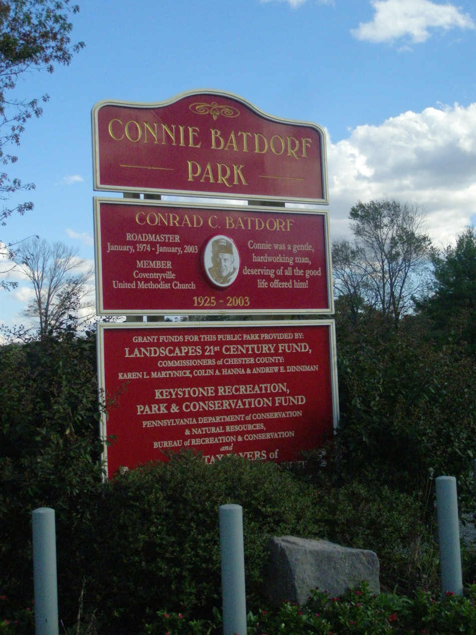
East Vincent’s Park on the Ridge: Active recreation & access to nature, all in one location

East Vincent’s Community Park on the Ridge has got every imaginable amenity for active family members of all ages. From the moment you turn off Ridge Road and into the driveway adjacent to the municipal building, you will be impressed at the landscape that unfolds before you. The park slopes downward from the playground, tot lots and pavilion, which are at the highest point. From there I took a path that led toward a small bridge. On the way, I passed a meadow and informative marker.

There are markers throughout the park that explain various ecosystems and notable environmental characteristics, such as riparian wetlands and hedgerows. It’s clear that whoever planned this park wanted to draw visitors’ attention to environmental resources as well as the active recreation that’s available in abundance.

For local teams, there are ball fields and soccer fields. The basketball, tennis and volleyball courts offer options for young and old alike. If you want to jog, or just take a walk while pushing a stroller, there are loop trails throughout the park so you can vary the scenery while getting your workout.

Exercise stations along the way offer additional challenges. I looked a good long while at the parallel bars, but decided against giving them a try; I wanted to finish this series without sustaining a single injury!

Although I don’t seem to have gotten a picture of it, there was actually a tetherball set-up. I remember playing tetherball at Laurelwood Pool in North Coventry many, many years ago, but haven’t seen the game in ages. In general, two opposing players hit a ball attached to a rope around a pole. One is hitting the ball clockwise, the other is hitting it counter-clockwise. The winner is the first one to get the rope wrapped all the way around the pole, going in their direction. Stop by Community Park on the Ridge and give it a try!

This park is the site of the Township’s Annual Community Day. Here are photos from the May 2010 event.

COMMUNITY PARK ON THE RIDGE
Location: 262 Ridge Road, Spring City, PA 19475, behind the municipal building
Size: 20 acres
Suitability: All ages. Site of Township’s Annual Community Day.
Facilities: Tables, benches, pavilion, grills, sand volleyball court, tether ball, basketball court, soccer & baseball/softball fields, tennis courts, environmental markers, meadow, ornamental gardens, trees, birdhouses, exercise stations, 2 trail loops. Pavilion is available for rental.
Activities and tips: How many exercise stations can you do? Give the classic game of tetherball a try! For facility rental, call the Township and use the form here.
Hours: Dawn until dusk.

For pavilion rentals, contact:
East Vincent Township
Pottstown, PA 19465
(610) 933-4424
Hours: 9 a.m. to 5 p.m. M-F
(Facility Rental Form)
Awesome website! http://www.eastvincent.org/

Follow the parks series at Mission: Healthy LivingPositively!PottstownTwitter(PositivelyPtown), Facebook, and The Mercury.

PHOTO GALLERY


Near park entrance


View across Ridge Road


Pavilion available for rent


Fall glory


Parking


Spring City’s Parks: A little bit of everything

Spring City is a relatively small municipality – population about 3,400 – whose recreational facilities run the gamut from neighborhood parks to the Schuylkill River Trail.

Hall Street Park

My first stop was Borough Hall because I knew that Hall Street Park was adjacent to it, but I also needed some directions to two other parks. To get to the park itself, just go around the right side of Borough Hall and head up Hall Street. It’s got a decent incline, so just be forewarned. On your left, you’ll see the two full-court basketball courts, which are in excellent condition. The fencing on two sides ensures that your ball won’t be sailing down to the sidewalk and street below (as long as your shooting or passing isn’t too erratic!) The fairly steep-sloped grassy open space beyond the courts is probably really good for sledding, but perhaps not for ball games. There are a few benches under some trees that might make a nice shady spot for summertime reading.

Spring City Pool

I got back in my car to get to the Brown Street Park, which is at the intersection of Brown and S. Wall Streets. I wished I’d been there on a summer day because this is the site of the Spring City Pool, which is run by a non-profit called The Community Association of Spring City. The public park also has facilities for tennis and basketball, a tot lot, open space and a pavilion. I imagine it’s a beehive of activity in the summers.

The Penn State study listed the third recreational location as the “Spring City Boat Ramp Area.” I couldn’t find any reference to it online. At Borough Hall, I was directed to the vicinity of E. Bridge Street and the bridge over to Royersford. On my way there, I stopped at the Burger King; no one there knew of any ramp on the Spring City side, but they did know the Phoenixville Boat Ramp. I figured I’d just go down to the river and have a look around anyway.

Royersford view

I’m glad I did because I got to take a walk along another segment of the Schuylkill River Trail, which was how I started out this whole series in Riverfront Park in Pottstown. Although I will wrap up the series with one more post tomorrow, this area in Spring City was actually the last one I visited, so it felt like a fitting end to my explorations.

I walked along the trail in a southeasterly direction. If I had kept going, I might have eventually ended up in Phoenixville, although I don’t think that segment is completed yet. There was some trail construction taking place on the section leading from E. Bridge Street north toward Limerick. When I got home, I found details about the project at the Chester County Parks & Recreation website. They are constructing a 15-mile section between Phoenixville Borough and Pottstown. The website says that, “The 12-foot wide asphalt-paved trail will use PECO Energy right-of-ways, roadways, a canal towpath, public and private open space, and existing bridge and culvert structures.”

I’m going to try to keep track of the improvements and connections being made on the Schuylkill River Trail. The Trail promises to become a premier, regional recreational destination, bringing economic development potential to the towns it passes through. It should be interesting and exciting to see that transformation take place.

HALL STREET PARK
Location: 6 S. Church Street, Spring City, PA 19475, behind Borough Hall.
Size: ~2 acres.
Suitability: All ages.
Facilities: Two full-court basketball courts, fenced on 2 sides; open, hilly, grassy open space, benches, some trees.
Activities and tips: Walking up the grassy incline got my heart pounding! I feel I should issue a warning: See your doctor before starting any exercise program.
Hours: Dawn to dusk.

BROWN STREET PARK
Location: Turn down Brown Street at the intersection with S. Wall Street. On a GPS or mapping program, use 50 Brown St., Spring City, PA 19475.
Size: Unavailable.
Suitability: All ages.
Facilities: Tennis, basketball, pavilion, public pool, tot lot, open space, parking.
Activities and tips: Tennis courts are inviting. Basketball court is in parking lot and might not be available when it’s crowded at the pool.
Hours: Dawn to dusk.

SPRING CITY SCHUYLKILL RIVER TRAIL
Location: Use 10 E. Bridge Street, Spring City, PA 19475 on a GPS or mapping program.
Size: Unavailable.
Suitability: All ages.
Facilities: Cleared and paved trail along Schuylkill River.
Activities and tips: Check Chester County Parks & Rec website before going out. Some parts of the trail may be closed while trail construction is underway.
Hours: Dawn to dusk.

Contact:
Spring City Borough (Chester County)
6 S. Church Street
Spring City, PA 19475
Phone: 610-948-3660
Website: http://www.springcitypa.net/

Follow the parks series at Mission: Healthy LivingPositively!PottstownTwitter(PositivelyPtown), Facebook, and The Mercury.

PHOTO GALLERY


Hall Street hoops

Hall Street hoops


Intersection, Brown & S. Wall Streets

Brown Street hoops

Brown Street tennis

Brown Street pavilion

Brown Street tot lot

River Trail

River Trail

Roots along the Trail

E. Bridge/Trail improvement area

E. Bridge/Trail improvement area

Coventry Woods: North Coventry’s natural wonder

On my first visit to Coventry Woods, I was alone on a Sunday afternoon. I found an access point at 2145 Coventryville Road, at the intersection with Chestnut Hill Road. After climbing an unpaved, steep incline in my car, the terrain leveled off and I came to a grassy parking area. From there, I could continue on foot in the same general direction or go off to the right, past a pavilion, down a trail clearly marked by bright red rectangles on tree trunks. I decided on the marked path, although there wasn’t a trail map at the trail head, so I didn’t know if the trail looped around or how long it was. I wasn’t comfortable heading off into the great unknown by myself, but I figured I’d at least walk a little ways to see what I could see.

Red trail, Coventry Woods

Within a few minutes, I noticed some trees with orange markers, and shortly thereafter came upon an impressive signpost. It was clear then that this park had an extensive trail system. Apparently, there are trail maps at other access points, but just to be safe, hikers will want to print out this Coventry Woods Trail Map before they head out to experience this awe-inspiring wilderness.

When I pulled out my copy of Walden by Henry D. Thoreau, which I was reading for my master’s writing program, I came across this quote: “I find it wholesome to be alone the greater part of the time. To be in company, even with the best, is soon wearisome and dissipating.” As much as I would have liked to be in sync with Thoreau in that moment in Coventry Woods, I just wasn’t. (Where was Rosemary and her entire family when I needed them?!)

Fortunately, I had my North Coventry guides on my second visit to Coventry Woods. We went in at the Fernbrook access point at the intersection of Fernbrook Lane and St. Peters Road. The Township recently acquired this 39-acre parcel with numerous buildings from Nueva Esperanza Youth Camp. The purchase was made possible by a grant from the Pennyslvania Department of Conservation and Natural Resources.

Fernbrook Access

This wasn’t the first purchase made from the former owners of the camp. Over the past several years, the township has been buying parcels as funding has become available. This area is part of the Hopewell Big Woods, generally known as the most important mature forested landscape in southeastern Pennsylvania. Plugging the Coventryville Road address into Google maps or Google Earth gives a pretty good idea of the scle of this valuable ecological and recreational resource.

A couple days after this visit, Jay Kline, planning commissioner, sent me a document from their Open Space Committee (North Coventry Saved Lands Stats). It shows that since North Coventry’s 2002 open space referendum, they have saved 1,163 acres – land that will not fall victim to suburban sprawl. Their $2.1 million in open space funds leveraged $13.4 million more in private donations and state and county grants. Those acres include hundreds that now make up the 600+ acre Coventry Woods property, which may eventually connect to French Creek State Park and be part of a greenway through the township that connects to the Schuylkill River Trail.

As we walked through the Fernbrook area of Coventry Woods, which contains about a dozen rustic buildings, Andy Paravis talked about the possibility of renovating one of them for use as a nature center. I thought the site had real potential to serve as a retreat for school groups, clubs, or families just wanting to camp for a few nights in the wilderness, but there are no funds or plans to put any of the buildings into use at this time. However, there is a large pavilion with a new grill that’s available for rentals. Just get in touch with the Township at the number below.

Photo courtesy of Jay Kline
I also learned from Mr. Kline that the directional signposts that I’d seen on my first visit were made from wood recycled from a demolished building at Camp Fernbrook. And he explained another marker that I recalled seeing – one that said, “Charcoal Hearth.”

Wood from Coventry Woods was burned in large outdoor hearths to make charcoal. “The remains of each charcoal hearth along the trail is marked with the pictured sign. Charcoal made at Coventry Woods was used at Hopewell Furnace to make iron,” wrote Mr. Kline in an email. There are numerous hearths noted on the trail map.

To learn more about Hopewell Furnace and the amount of charcoal they needed, see this link. Mr. Kline also sent a link to this site, which explains the charcoal hearth model that was carried out in Coventry Woods.

What was really striking to me on the way back from Coventry Woods to the township building, via North Coventry’s riverfront parks, was the absolutely breathtaking farmland, the rolling fields and the autumn colors as a backdrop. And then, as we got closer to the river and the more densely-populated areas of Pottstown Landing and South Pottstown, we were clearly returning to the region’s town center – Pottstown. It seemed so obvious then, how regional planning should work: a greenbelt around what could be a thriving urban center. Despite all its complexities, it’s a goal to keep moving toward.

I’d like to thank Andy Paravis, Jay Kline and Police Chief Robert Schurr for their time and for providing so much information on North Coventry’s parks and open space.

COVENTRY WOODS
Location: 2145 Coventryville Road, Pottstown, PA 19465. Fernbrook Access: 1954 St. Peters Road, Pottstown, PA 19465
Size: 600+ acres
Suitability: All ages, except very young children will not be able to cover much ground on this sometimes hilly terrain.
Facilities: Trails, pavilions, and wilderness hiking through mature forest.
Activities and tips: See the map link in this article for other access points and parking locations.
Hours: 7 am to sunset.

Contact:
North Coventry Township
845 So. Hanover Street
Pottstown, PA 19465
Phone: 610-323-1694
Fax 610-323-7239
Mon-Fri 8:30a-4:30p
Website: http://www.northcoventry.us/

Follow the parks series at Mission: Healthy LivingPositively!PottstownTwitter(PositivelyPtown), Facebook, and The Mercury.

PHOTO GALLERY


Access road (to left) from Coventryville Rd. entrance

Pavilion near Coventryville Rd. access

Charcoal Hearth marker, courtesy of Jay Kline

Signpost made from recycled wood

Fernbrook access intersection

View from Fernbrook entrance

Another Fernbrook view

North Coventry parks offer river re-connection possibilities

North Coventry's boat ramp

At first, North Coventry’s parks along the Schuylkill River, just across the Hanover Street Bridge from Pottstown, presented a bit of a challenge. But it wasn’t due to any particular feature of the parks. It was their names. The names in the Penn State study didn’t seem to match up with what I could find online and there were no signs at the actual locations. Fortunately, I was able to get in touch with Andy Paravis, Chairman of the Board of Supervisors, and get to the bottom of things. We met at the Township building this past Friday, where I also met Jay Kline, chairman of the planning commission. They had several maps of the township’s parks and open space, and before the morning was over, I had learned a whole lot more about North Coventry’s open space accomplishments and some of the potential going forward. I’ll fit some of it into this post and more in the next one on Coventry Woods.

Sometime in the past few years, North Coventry grouped together several parcels in the South Pottstown area and now refer to them collectively as “Riverside Park.” These include: the boat ramp and parking areas near the intersection of Penn Street and E. Schuylkill Avenue; the Penn Street courts (basketball & tennis, not in use), and the horseshoe pits in a green space on E. Schuylkill Avenue at the intersection with Hanover Street. (The nearby Wampler Complex has four baseball fields which are owned by the Coventry Little League.)The Riverside Park designation also includes the ~1.4 acre park on River Road between S. York Street and Coyne Alley; this parcel has a playground, shade trees, picnic table and open space.

Further down River Road, at the bend in the road, you will come upon River Bend Park. This facility is home to the North Coventry Athletic Fields, and each of its three fields is dedicated to the memory of someone who contributed to the life of the Township: William R. Deegan, Sr., James R. Batdorf and Vernon Anderson. Near Batdorf Field there is a small pavilion with picnic tables and a swing set.

There is a noticeable difference in the quality of equipment between Kenilworth Park and the facilities that make up Riverside Park. Mr. Paravis confirmed that it’s a matter of money. Funds available for acquisition of properties are not allowed to be used for general stewardship, leaving some towns unable to maintain all of their parks to the same standards. I asked if there were any plans for the asphalt on Penn Street, where the tennis courts used to be and where there is still one basketball hoop.

“We’re going to have to re-consider those areas,” said Mr. Kline. “No one was really using the tennis courts.”

This was also the case at Pottstown’s Polluck Park, and I wondered if this was due to the “professionalization” of tennis for young children or due to more people playing year-round at indoor facilities. I may take some heat from Pottstown folks for thinking out loud that a reconfigured parking lot in the boat ramp area of North Coventry might be just the place for a kayak and canoe concession to attract more visitors to the river. Those visitors are going to be hungry when they get out of the water, and Pottstown should be the place they head for refreshments… which brings me to a subject that is close to Mr. Paravis’ heart: regional planning, in general, and regional recreation planning, in particular.

There is a really interesting study on my Pottstown 101 reading list about the ways in which Pottstown and North Coventry could coordinate the development of their riverfront recreational resources. It’s called Reconnections: “Reconnecting the people of North Coventry Township and Pottstown Borough with each other and their Schuylkill River Heritage.”

I took a ride with my North Coventry guides to visit Coventry Woods, which I’ll talk about tomorrow. On the way back, we detoured over to River Bend Park, where – if you get close to the river’s edge – you can see an old railroad trestle that crosses the river. The Reconnections study has a nice rendering (on page 40) of what that might look like as a pedestrian bridge that could allow people to cross from North Coventry and end up in Pottstown’s Riverfront Park, basically creating, for hikers and bikers, a loop with the Hanover Street and a larger loop with the Keim Street and Kenilworth bridges.

The study also presents some creative, upscale ideas for improving the gateway appearance and the pedestrian experience on the Hanover Street Bridge… for all those residents and visitors trying to enjoy the best that both sides of the river have to offer. With this kind of teamwork, I can easily envision a more vibrant waterfront for both Pottstown and North Coventry.

For those who are interested to learn more, I highly recommend the Reconnections study.

RIVERSIDE PARK
Location #1: E. Schuylkill Ave. and Penn St., Pottstown, PA 19465
Location #2: River Road & S. York Street, Pottstown, PA 19465
Size: ~2.5 acres total
Suitability: All ages.
Facilities: Location #1 – Boat ramp, dock, quoits, benches. Basketball court and two tennis courts are no longer in service. Location #2 – River Road area offers playground, shady seating area and large multi-purpose open space. Two volleyball courts are no longer in service.
Activities and tips: On the Sunday I visited, several people were putting their boats in. Isn’t it time to seriously consider getting a boat of your own?
Hours: 7 am to sunset.

RIVERBEND PARK & ANDERSON FIELD
Location: River Road, Pottstown, PA 19465
Size: ~9.5 acres total
Suitability: Youth involved in North Coventry baseball, softball and soccer leagues.
Facilities: Baseball/soccer fields, river views, benches, tables in grove, pavilion, swings.
Activities and tips: Looks like there used to be a trail along the river’s edge, beyond the ball fields, but it’s mostly overgrown now.
Hours: 7 am to sunset.

Contact:
North Coventry Township
845 So. Hanover Street
Pottstown, PA 19465
Phone: 610-323-1694
Fax 610-323-7239
Mon-Fri 8:30a-4:30p
Website: http://www.northcoventry.us/

Follow the parks series at Mission: Healthy LivingPositively!PottstownTwitter(PositivelyPtown), Facebook, and The Mercury.

PHOTO GALLERY

Entrance to Riverside Park boat ramp

Wampler Complex

Riverside Park Hoop

Riverside Park, former tennis courts

Riverside Park, Location #2, view from River Road

South York and Main Streets, South Pottstown

Riverside Park tot lot

At River Bend Park


On the road…

I meant to post earlier, but I had limited email access today, and I was on the road… in North Coventry (fact-checking), South Coventry (stopping by Woody’s Woods), and East Vincent and Spring City (checking out their parks!)

I’ll be posting more on North Coventry’s parks this weekend and then will pick up with East Vincent and Spring City later next week… after Election Day has come and gone 🙂

In the meantime, check out the recent article on Connie Batdorf Park in South Coventry. Mrs. Peg Batdorf wrote in after reading the story. I’m honored to be able to post her response. Thank you, Mrs. Batdorf!

You might also want to see the newly added notes and photos for Woody’s Woods at the end of that same article.

And I’d like to send a big shout-out to reader Elise Buskirk, who pointed out something I missed at Kenilworth Park! Read the updated blog entry here. Thank you, Elise!

And now, a feast for the eyes…

Fall Glory, Community Park on the Ridge, East Vincent Twp.

Kenilworth Park: Classic community park with water views

Last Sunday we were blessed once again with mostly sunny skies and moderate temperatures, and active residents of North Coventry were out in their parks in full force.

I have vague recollections of playing softball in Kenilworth Park many years ago, but was blown away by its current facilities. Scherfel Field, which was the site of a baseball game on the day I visited, is well-groomed and seems to have been recently updated. There was a strong contingent of family and friends cheering the boys on. As a couple children climbed and swung on the nearby playground equipment, a foursome expertly battled on the tennis courts. While all these facilities are in excellent condition, what makes Kenilworth Park unique is its lake and trails system.

The trails around the lake and in the woods behind and adjacent to Scherfel Field provide a chance to re-connect with nature before or after a game, on a daily walk or perhaps a few times a week to de-stress after work. The lake view is very soothing. Visiting the park on your lunch hour might also do the trick, since there is a new lake overlook area with beautiful pavers, tables and a grill. Coming alone or with some friends in the middle of the day just might release those knots of tension in your neck and help you get through the afternoon!

Kenilworth Lake

Kenilworth Park has another ball field that did not seem to get much use for baseball or softball. There was a soccer net set up in the outfield, indicating its use for that purpose. There is a very nice pavilion, which is available for rent from the Township for family and group gatherings.

Although the main entrance with a plaque memorializing the development of the park is at the intersection of Brown Street and Keller Road, there is another entrance at the intersection of Scherfel Boulevard and Park Avenue (which is off Route 724.) Going in through the latter entrance will bring you to a couple of parking areas, including the one closest to Scherfel Field, the lake and the overlook. While North Coventry families with children active in sports will already know about this park, all area residents who are interested in water views and a tranquil hiking experience will want to check out Kenilworth Park.  

On October 29, 2010 Elise Buskirk wrote to let me know that a township building near the tennis courts in Kenilworth Park is the home of The Tae Kwon Do Academy. This school and facility offer even more opportunity for physical activity for all who are interested. Here’s what Elise had to say:

… I spend a good portion of my week in the township building studying Tae Kwon Do. The Tae Kwon Do Academy with head instructor Mr. Jay Erb rents the building from the township to offer classes to township residents and others that wish to attend. The school is a not for profit school and has been located in the Kenilworth Park township building since 1995. Since the Tae Kwon Do Academy has been in the building the students have taken on the majority of the upkeep of the building such as general maintenance, painting the interior, trimming the bushes and this year we are painting the outside of the building.

Sounds like a wonderful community! Thank you, Elise!

KENILWORTH PARK
Location: Scherfel Boulevard & Park Avenue, Kenilworth, PA OR Brown Street & Keller Road, Kenilworth, PA
Size: 24 acres
Suitability: All ages.
Facilities: Baseball/softball fields, tennis courts, one tennis court doubles as a basketball court, soccer fields, playground, picnic pavilion, lake, paved overlook area with tables & grill, fishing, hiking/walking trails, gardens.
Activities and tips: Be sure to visit the lake area and trails. The pavilion is available for rent on a first-come, first-served basis. Contact the Township for details.
Hours: 7 am to sunset.

Contact:
North Coventry Township
845 So. Hanover Street
Pottstown, PA 19465
Phone: 610-323-1694
Fax 610-323-7239
Mon-Fri 8:30a-4:30p

Website: http://www.northcoventry.us/

Follow the parks series at Mission: Healthy LivingPositively!PottstownTwitter(PositivelyPtown), Facebook, and The Mercury.

PHOTO GALLERY

Entrance at Brown & Keller

Entrance at Park & Scherfel

Tennis/B-ball courts


Kenilworth Park Pavilion

Lake overlook

Kenilworth Park path

Connie Batdorf Park & Woody’s Woods: Tributes to upstanding citizens

South Coventry Township has started what seems to be a fitting tradition: naming its parks and open space after individuals who cared for the land or were instrumental in the Township acquiring the land for generations to come. Every town needs these kinds of citizens.

Connie Batdorf Park is home to the Norchester Red Knights football program in the fall and the Coventry Youth Lacrosse Association in the spring. In addition to the large playing field, there is an excellent playground with new equipment and a pavilion with tables available for fans or for rent for special occasions.

The beautiful red sign that lets visitors know they’ve arrived at the park also lets them learn a bit about the park’s namesake, Conrad C. Batdorf. He was born in 1925 and was a “Roadmaster” for the Township from 1974-2003, the year he passed away. The sign says, “Connie was a gentle, hardworking man, deserving of all the good life offered him!” I get a little choked up whenever I read that. We can’t ask for much more than that – to be remembered well.

Batdorf Field

When I called the Township to get the scoop on the park, I asked Millie Donnell, a Supervisor and Secretary/Treasureer, about the term “roadmaster” because you don’t hear it very often. It refers to what most of us might call someone in “public works.” Apparently, Mr. Batdorf was in charge of South Coventry’s roads and parkland for all those years.

It was a good thing I had Ms. Donnell on the line or I might not have found out that they also have a 250+ acre tract called Woody’s Woods, which has hiking trails, unique flora and fauna, and is open for bow-hunting season. I’m not sure why Woody’s Woods wasn’t listed in the Penn State study because the Township has owned it for several decades. This wilderness area is named after a former Supervisor, W. Richard Whitlock, Jr., whose nickname was “Woody.” He was instrumental in starting the land acquisition process back in the 1970s.

According to Ms. Donnell, there are steep entrances to Woody’s Woods off of Coventryville Road and Harmonyville Road. The latter entrance is overgrown now, and the Township is going through a master site plan process now to reconfigure the entrance to make it more accessible. Because I didn’t know about this parcel, I didn’t visit it when I was in South Coventry last week, but I will get to it at the end of this week when I’m back in the area. I’ll be sure to let you know what I find and will upload some photos then.

This article was amended on October 29, 2010 with photos of Woody’s Woods and the following note:

Mrs. Peg Batdorf, wife of Conrad Batdorf, commented on October 28, 2010:

I was very excited to see the article written about the C.B.Park.
When the park was pre-dedicated at it’s incept, my husband was living at the time and was very humbled, and surprised to be honored in this way. As time passed and his illness progressed, we visited the Park several times. He would be very proud of the additions and improvements made that have made this Park a great asset to our Community. Thank You so much, Ms. Repko, for writing this article.
Sincerely, Peg

Thank you very much, Mrs. Batdorf, for sharing your story!

CONNIE BATDORF PARK
Location: 2350 Pottstown Pike, Pottstown, PA 19465 (across from the Plaid Pig and the Shoppes at Pughtown) Pottstown Pike is also known as Route 100.
Size: 2 acres
Suitability: All ages.
Facilities: Football/lacrosse field, pavilion, playground, port-o-potties, ample parking. The pavilion is available for rent; see contact details below.
Activities and tips: Children will enjoy the whirling contraption and seesaw.
Hours: Dawn to dusk.

WOODY’S WOODS
Location: Main entrance: 3131 Coventryville Rd., Pottstown, PA 19465. There is another access point at 1560 Harmonyville Road.
Size: 250+ acres
Suitability: Hikers capable of making steep climb into wilderness area.
Facilities: Woods, trails, unique flora & fauna. Limited parking at both access points.
Activities and tips: Hunting is allowed. Hikers are not allowed in the park Monday-Saturday during bow-hunting season. Hunting is not allowed on Sundays, so hikers may enter the park then. Hunters & hikers alike should be aware of their surroundings at all times.
Hours: Dawn to dusk.

For pavilion rentals at Batdorf Park, contact:
South Coventry Township
1371 New Philadelphia Road
Pottstown, PA 19465
(610) 469-0444
(610) 469-0520 FAX
Hours: Mon.-Thurs.: 9 a.m. to 4 p.m.; Friday by appointment.
Website: http://www.southcoventry.org/index.html

Follow the parks series at Mission: Healthy Living, Positively!Pottstown, Twitter (PositivelyPtown), Facebook, and The Mercury

PHOTO GALLERY

Batdorf Park Entrance

Batdorf Park Pavilion

Batdorf pavilion dedication

Batdorf Park playground

Batdorf see-saw

Dizzying contraption

Park is across Route 100 from Plaid Pig!

Photo courtesy of South Coventry Township

Woody's Woods, fall view

Woody's Woods incline

1560 Harmonyville Road entrance

Towpath Park, where canal history comes alive

East Coventry Township has just two parks, but each one packs quite a lot of possibility into its space. Yesterday I told you about my visit to Ellis Woods Park, and today I’d like to share my impressions of Towpath Park, a grassy strip that lies between Route 724 and the Schuylkill River and Schuylkill Canal. To get to Towpath, turn into the park across Route 724 from the old, overgrown Pizza World at the intersection with Peterman Road.

Although you wouldn’t know it unless you are middle-aged or are wasting time on the Internet :-), the entrance to Towpath Park is perhaps best known as the longtime resting place of the former Rosedale Diner of Pottstown. A photo of the diner was featured on the cover of Daryl Hall & John Oates’ 1973 album, “Abandoned Luncheonette,” which contained the hit “She’s Gone.”

Moving on to more traditional historical matters, just as Ellis Woods Park & the nearby cemetery provided me with a little history lesson, Towpath Park provides some very interesting information about the Schuylkill River canal, the transportation of goods in the 1700s, and what life was like in the area of Frick’s Locks.

As part of his Eagle Scout project, William Dougherty erected a series of four story boards within Towpath Park memorializing the Schuylkill River Navigation canals. (He’s the same young man who made the awesome trail signs in Ellis Woods Park.) It’s best to read the historical markers in order. The first one is located near the children’s playground, which is on your right as you enter Towpath Park. (Except for an oversized, lone metal turtle, the play equipment has been removed, but plans are in the works for replacements.) The first marker is entitled, “Towpath Park Historical Trail.” As you move through the park, parallel with Route 724, you will come upon the other markers: “Life on the Canal,” “Schuylkill Navigation Company,” and “Canal Construction.”

According to the Schuylkill River National and State Heritage Area, between 1816 and 1825, the Schuylkill Canal was built by the Schuylkill Navigation Company to help move anthracite from the coal regions to Philadelphia. If you want to read more, check out their website.

But Towpath Park is not just for budding history buffs. It’s got a wide array of other facilities including a volleyball net, picnic tables, grills, port-o-potties, plenty of parking, a boat launch and mini-dock. The boat launch was upgraded about three years ago when the access road and approach to the boat ramp were paved to improve safety and maintenance. It also provided additional signage to encourage use of the launch. I was there on a gorgeous fall afternoon, and the water looked so inviting. I really wished I had a boat. Why don’t I have a boat? I wondered. I’ve enjoyed kayaking a few times when I’ve visited friends in Canada in the summers. A simple kayak or canoe would suffice in times like these. It’s not such a major investment. This is definitely something to antagonize my husband about as soon as I get home. “Honey, why don’t we have a boat?” On the other hand, an outfitter on High Street could be a really good business. Then I could just rent a kayak there. Oh… I’m actually blogging now…must get back to story…

Towpath Park serves as a gathering spot for children’s summer programs, the annual Township Park Day in June and an annual stream cleanup day. The park pavilion is also available for rentals, just get in touch with the Township at the number below…. And may all your boating dreams come true!

TOWPATH PARK

Location: Route 724, Pottstown, PA 19465, at the intersection with Peterman Road, across from Pizza World and the veterinary hospital
Size: 7 acres
Suitability: All ages. Site of several annual Township events.
Facilities: Tables, benches, pavilions, grills, volleyball, boat ramp, dock, port-o-potties, historical markers, contact with nature, water views. Pavilion is available for rental.
Activities and tips: The old playground equipment has been removed and plans are being made for its replacement. Young children through adults will enjoy the four historical markers which give some local history in manageable chunks.
Hours: Dawn to dusk.

For pavilion rentals, contact:

East Coventry Township
855 Ellis Woods Road
Pottstown, PA 19465
(610) 495-5443
(610) 495-9925 FAX
Hours: 8 a.m. to 4 p.m. M-F
Website: http://www.eastcoventry-pa.gov/

Follow the parks series at Mission: Healthy LivingPositively!PottstownTwitter(PositivelyPtown), Facebook, and The Mercury.

PHOTO GALLERY


Canal Path


TowPath Park Open Space


Tow Path


The End


Table & mini-pavilion


Playground, waiting for new equipment